
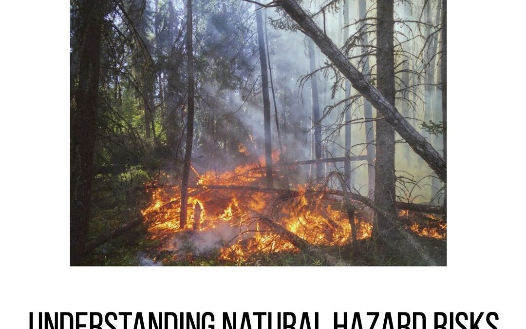
Natural hazards, such as earthquakes, volcanoes, and landslides, can strike anywhere at any time. These events can cause significant damage to property and human life. For example, earthquakes account for about half of all-natural disasters globally (World Bank).
Accurate hazard risk assessment is essential for effective disaster risk management. This requires accurate location data that can be used to map areas at risk of different types of natural hazards. Inaccurate or missing location information can lead to inaccurate mapping and inaccurate assessments of risk.
The location of an event is often critical to understanding the risk of a particular hazard. For example, data about flood risk in the United States is typically based on the location of a floodplain map. Agencies and Businesses have provided funding to improve the accuracy of location data in Europe, which will help improve disaster risk management by providing more accurate hazard maps.
Inaccurate information about natural hazards can lead to problems such as under- or over-insuring property owners against losses due to disaster events or failing to identify areas where public infrastructure needs improvement. Accurate location information is also important for planning purposes so that communities can be prepared for potential disasters by taking action before one occurs instead of waiting until afterwards when it may be too late!

Instagram Influencers
Discovering hidden gems: Location intelligence reveals secret spots and trendy hideaways that even Instagram influencers haven't found yet!

Track hiking adventure
Real-time location sharing: Let your friends track your hiking adventure or escape from a corn maze—no compass required!

Fast Delivery
Optimizing delivery routes: Getting your goodies to your doorstep faster than a cheetah with a jetpack! FollowFollowFollowFollowFollow Feature Posts

Discount favorite store
Location-based deals: Unlock discounts when you're near your favorite store. Who said shopping can't be a treasure hunt? FollowFollowFollowFollowFollow Feature Posts


Gonigs Christmas 2023
🎄✨ Merry Christmas from Gonigs! 🌍🎁 Wishing you a joyous holiday season filled with laughter, love, and the warmth of family and friends. 🎅🤶 May your celebrations be as precise and delightful as our location intelligence solutions! 🌐❤️ Cheers to a year filled with new discoveries and successful journeys! 🚀🎉…
Find Customers
Finding your customers' favorite hangouts: Location intelligence helps businesses discover where the party's at! FollowFollowFollowFollowFollow Feature Posts
Putting Your Business On The Map
Putting Your Business On The Map: Navigating the Digital Landscape In the ever-evolving digital era, putting your business on the map takes on a whole new meaning. No longer confined to physical locations, businesses now have the opportunity to establish a global presence through the power of the internet. However,…

Market Expansion With a Dash of Adventure
Market Expansion with a Dash of Adventure: Location Strategies Guide Us on a Thrilling Journey to Explore New Markets and Leave Our Mark --- In the ever-evolving landscape of global business, expansion is not just a choice; it's a necessity. Every successful company dreams of growing beyond its current borders,…
Cracking The Location Code
Cracking The Location Code: Unraveling the Secrets of Geographic Significance In our ever-connected world, where information travels at the speed of light and distances seem to shrink, location remains a pivotal factor that shapes our lives in profound ways. Whether it's the buzzing metropolis where dreams are woven into reality…